Over Labor Day Weekend, we made our first camping trip since moving to Colorado. We left home Saturday morning, our truck loaded with bicycles and camping gear, heading to a campground not too far from Leadville. Until we changed our plan, that is. We weren't far down the road when we decided to go back to the Fraser Valley instead. We made that last-minute decision because the Fraser Valley was familiar, it was reasonably close, and generally seemed like a safer bet than risking our only camping trip on a place less familiar.
There are plenty of trails and gravel roads in the Fraser Valley for hiking and cycling, and the trails are dog-friendly, so Amos could come along with us.
Here's a map. Our hope was that we could mix things up with some rides done by all of us, and some with subsets. It sort of worked out that way.
We camped at the Saint Louis Campground just outside of Fraser, which is slightly north of Winter Park. There aren't many live trees left in the area since the pine beetles have killed so many of them. The Forest Service has removed the dead trees from the campground -- it would not be safe to have people camping in a forest of dead and falling trees. Perhaps that's partly why the campground was only about half full on Labor Day Weekend, although the camp host said they'd been full every weekend during the preceding month.
Upon arriving at the campground Saturday morning, we selected a campsite and set up the tents, and then had to fix flat tires on Quinn and Cindy's bikes from thorns picked up the previous day on a ride near our house. I lost count of all the thorns we found in Quinn's tires. Only his front needed to be fixed since the self-sealing tube in his rear tire did its job.
After the tire repairs and a quick lunch, the five of us ("scaqa," if you want to add Mousie to the acronym) headed up the Creekside Trail, which runs right through the campground. It is a very pleasant, somewhat rocky trail than meanders through the forest and meadows on the west side of Saint Louis Creek, going upstream towards the south for about two miles. We'd ridden it a few times over the summer already. This time, however, rather than coming back down the Flume Trail on the east side of the creek, we headed further out and up to catch Zoom and Chainsaw which loop around and meet up with Creekside (and Flume) a little downstream of the campground. It was great loop, although the climb up the gravel roads to Zoom was tough -- especially for Quinn. He made it, though, and he definitely enjoyed the subsequent ride down Zoom and Chainsaw. Chainsaw is a really nice, well-designed trail that flows nicely downhill toward Saint Louis Creek.
We love the log skinnies on Creekside:
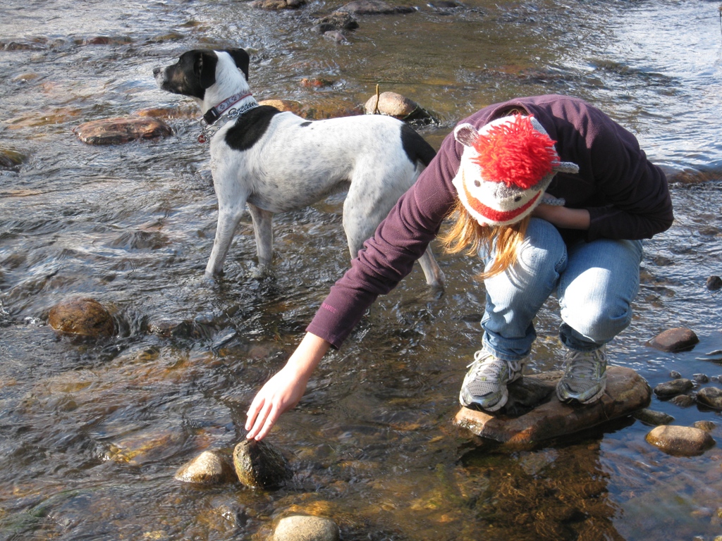
Coming down Chainsaw Trail was easy for those of us with wheels, but Amos had to run hard to keep up. We gave him time to rest in the shade.
An overlook of Saint Louis Creek, pooled by beavers.
With a good, long ride out of the way, we ate some sandwiches at the picnic table, and then, of course, got back on the bikes for more riding. Quinn and I set off for a quick loop up Creekside and down Flume, while Cindy and Abbey relaxed at the campground with Mousie. After we returned, Cindy and Abbey made the same loop while Quinn and I watched the storms roll in. We prepared the tents and campsite for rain, and when it hit, with wind and lightning, Quinn and I sat in the comfort of the truck, wondering how Cindy and Abbey were doing out on the trail. They survived, and didn't get as wet as we'd expected, but the rain didn't last very long. Interestingly, and most excitingly, I think, the wind blew down a tree in front of Cindy and Abbey as they were riding down Flume Trail. They heard it crack, saw it fall, and then had to cross over it to continue down the trail. I wish I'd been there for that one!
Once they were back, the storms moved out and we got down to the business of camping. Much of our camping gear had been unused for at least a year, but it seemed to have survived the time in storage. Everything worked out well, and we had a really nice trip.
We brought two tents: our big four-person tent for the two girls, and our slightly smaller three-person tent for the three boys. Quinn and I must have drawn the short straw: we had the fun of sharing a tent with Amos. Our three-person tent had sustained some damage to the floor several years ago, and while it's been repaired, we prefer having Amos in that one to having him in the newer tent with the undamaged floor. To prevent further damage, we spread out a big thick fleece blanket in the tent, and put Amos's little bed between our sleeping bags. It's really ridiculous. I don't think Amos belongs in the tent at night, but what else are we going to do with him?
With the trees gone, the campground is wide open. We thought we might feel very exposed; there was certainly no shade for us humans. Amos found his shade under the picnic table. We were lucky to have a quiet and respectful group in the campground, mostly families like us, with kids, dogs, bicycles; it was like a small community. Since all were quiet and polite, it was really very enjoyable, despite the lack of privacy.
We only camped for one night since Cindy had to work on Labor Day, but we had a little campfire, roasted real beef hot dogs (the fancy all natural sort) and made s'mores. It was a beautiful night, slightly chilly, with a big full moon. Just about perfect. Of course, the next day we all felt those hot dogs -- what were we thinking? All natural or not, they were still hot dogs.
After a good night's sleep, we awoke to near-freezing morning air. It took multiple rounds of coffee and hot chocolate and big bowls of oatmeal to warm us up. After breakfast we walked along Saint Louis Creek. Amos splashed back and forth across the creek while the kids and I looked for invertebrates on the undersides of stones downstream of a big beaver dam.


Quinn, Amos, and I sat out the first ride of the day since Amos's feet were still recovering from the Gold Dust Trail the previous weekend. We shuttled Cindy and Abbey up to the starting point on Tipperary Creek Trail; they road up Tipperary, down Spruce Creek Trail, over to Flume and back to the campground. Quinn and I packed up our tent, organized the truck, and started lunch preparations. Cindy and Abbey looked very hungry when they rolled into the campground sometime later. I guess the climb up Tipperary was pretty long. Did I say it wasn't? It didn't seem like they enjoyed the ride down Spruce Creek much either as it was quite steep with lots of loose rock. Sometime I'll have to try it.
After lunch I set off to ride up Creekside and up the gravel roads, as fast as inhumanly possible if possible, just for fun, for another round of Zoom and Chainsaw. I wasn't able to convince Quinn to tackle those gravel roads up to Zoom, so Cindy brought him to meet meet me at the Zoom trailhead, where Zoom starts it's downward course. We learned from some other riders at the trailhead that there is another trail called Iko, or something like that, that splits off from Zoom and goes downhill to where Elk Creek Road meets Chainsaw. So we tried it. It was a fun ride, quite awesome really, although there were a few short trail segments that were not well-designed and could use some rerouting or maintenance. After Iko, we climbed up and down Chainsaw to get back to the campground. Only later did I start wondering about the implications or ethics of using an unmarked trail. Is this a legal trail? Is it legal to ride it? Who maintains it? It's not on any of the maps and there's no sign for it, but it clearly gets lots of use. It's not clear whether we actually should ride such a trail. Of course, Winter Park advertises 600 miles of "marked and unmarked" trails.
And then we went home.