Tuesday, July 8, 2014

Independence Weekend in Fraser

We are staying so wonderfully busy that it's nearly impossible to make time for updating this blog. This summer Abbey is volunteering at the Denver Zoo, which seems at times to be a full time job, excepting the pay, of course. And she's keeping up with her trumpet, mellophone, and singing and guitar playing, as well as spending too much time texting boys. Quinn is spending too much time with his phone, too, although in the form of gaming more so than texting. He is continuing trombone lessons and playing in the Colorado Honor Band. And learning to ride wheelies. Cindy and Abbey have been running, and we're all trying to log as many miles as possible on our mountain bikes so that we can comfortably do some more ambitious, longer, higher elevation rides this summer and fall.

So I've failed to post a few significant events. One was this Buffalo Creek ride with Heather, Chris and Cailan. It was the same loop I'd written about here and here. It was especially notable because Chris and Cailan rode our black Fandango tandem. I forgot my camera, but Cindy caught this one with her phone:


But that was back on May 10th, and this story isn't about that. This story is about our Fourth o' July trip to Winter Park and Fraser....

It was sort of last minute, or last week, when we decided that we ought to get together for the extended weekend and do something fun in the mountains. We scrambled a bit to figure out we could do that would work for all of us, and wouldn't break the Cindy-doesn't-drive-a-bus-during-summer-so-we're-short-on-funds bank account. We ended up renting a townhouse in Fraser for a couple of nights and riding the now-familiar Winter Park trails. No lift-served rides this time, to Quinn's dismay.

For the record, here's what we did:
  • July 4th: First a Blue Sky area loop with some "D" trails mixed in. Then, after dinner, a loop around Creekside and Flume. All of that was caught on a single GPS track: Click her for the Garmin link. It includes the drive to the house, so don't think the 50 mph max was done on my bike.
  • July 4th: Another loop, nearly in the dark, around Creekside and Flume.
  • July 5th: Devils Thumb Ranch. This was new for us. Sort of interesting, a private ranch with cross country ski trails open to bikes during summer, but not likely something we'll do again.
  • July 5th: After some lunch back at the house, Elk Meadow, Sunken Bridges, Zoom, and Chainsaw. This was nice, but Zoom is really getting rough. We heard from a local that there's a secret, rogue, alternative trail that is better designed and may soon replace Zoom altogether.
  • July 6th: To wrap things up, the Tipperary Creek loop. This trail is becoming Cindy's nemesis.
It's getting to be time to replace my old camera. Most of the pictures on this blog, and the original scaqabout were taken with a Canon Powershot A1000 that we've had for years. Not sure if this is really possible, but I think it's not focusing as well as it used to. And now it's lens cover is sticking half-way closed. So I'm probably going to need a new camera, but I'd rather get a dropper seatpost.

Amos came with us on our first loop, Blue Sky, but his pads weren't up to the abuse and he was limping on injured feet by the time we were done. We think he had a blast, but after that first ride, he spent the rest of the weekend hanging out in the house with Sharon. Poor guy could hardly walk, so he didn't seem to mind staying behind.


Devil's Thumb Ranch had some really nice scenery, and some of the the trails were good, but many of the trails had not really been built beyond a rough cut into the hillside for skiing, and others seemed to disappear into the forest, grass, and marshes. This is Quinn and Heather taking in the view.


The Elk Meadow Trail was nice. Plenty of cruising through forest on smoothly flowing trail.


Sunken Bridges, obviously. Lots of caddisfly and mayfly larvae in this little pond. Some other critters, too. Cailan may remember all of them.


Heather and Abbey finishing out the ride on the last bit of Chainsaw.


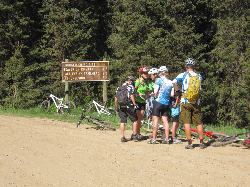
After a few miles of gentle climbing on a gravel road, the Tipperary Creek Trail climbs right at 1,000 feet in two miles. It's a smooth trail, so it's not terribly difficult, but it tops out at over 10,000 feet. So before we started the big climb, we stopped at the sign for peeing and a snack.

This is the first crossing of Tipperary Creek. It was nice and easy this time, but last summer, you might recall, there was quite a drop from the trail coming into the water, and Cindy took a chilly splash.


It's a beautiful valley. The sunny meadows are hot.


We were all impressed by Chris's strength and determination in climbing Tipperary with Cailan on the tandem.


The second crossing of Tipperary Creek at the top of the steepest two miles. The cold water was a welcome refreshment for our overheated bodies.


The descent from Tipperary back to Flume and on down Creekside to the parking lot is speedy. At the top it's very loose and very steep. Rather hazardous. Cindy took a nasty, scary spill at cruising speed, bruising and scraping most of her surfaces. She's OK now, still sporting bruises and scabs and either a bruised rib or a pulled muscle in her back, but she seemed a bit shaken up at the time. 

And then we engulfed a delicious high-calorie lunch at Elevation Pizza in Fraser before heading home.

Friday, June 27, 2014

Estes Cone Backpacking

This was our third consecutive weekend in Rocky Mountain National Park, and our first backpacking trip in Colorado. In fact, the last time we did any backpacking was before we left Seattle back in 2006. Recently, Abbey had been asking to do some backpacking, so this spring we marked out a couple of weekends on our summer calendar with that in mind. This was the first. We wanted to do something fun and easy for our first time out, so last weekend when we were in Rocky Mountain NP we stopped in to the Backcountry Office and inquired about possible sites that might make good options for us. We didn't necessarily expect any sites to be available, as permits are required for backcountry camping in RMNP and can be reserved in advance, but the ranger pulled up a couple sites that could work for us and were available, so we made a reservation for a site called Moore Park.

We started making some preparations for backpacking during the spring; mostly that meant thinking about what gear we had and what we might need. The only significant item we had to buy was a new pack for me, as our oldest packs had begun to degrade and we'd gotten rid of them a while back. So we had picked up a new one for me a few weeks ago during a sale at REI. We had a couple of smaller, not quite so old packs that fit Cindy and Abbey, and a large daypack that squeezed down just small enough for Quinn. We also had to put a new cartridge in our water filter and replaced the o-rings in one of our old MSR stoves. The National Park Service requires that backcountry campers store food in bearproof canisters, so on Friday, after taking Abbey to her volunteer job at the Denver Zoo, Cindy stopped by REI and rented a canister for the weekend. With that, were ready to hit the trail.   

We packed up Friday night, and left the house before 7 a.m. on Saturday. That got us to the Longs Peak Ranger Station at about 9 a.m. On summer weekends, the Longs Peak Trailhead parking apparently fills up by 3 or 4 a.m. with the vehicles of climbers getting an early start for the ascent of Longs Peak. So we were lucky that someone was leaving as we arrived and we got a spot in the lot. In the photo below, Quinn and Abbey have their donned their loaded packs while Estes Cone, our eventual destination, stands tall in the background. 


Our campsite at Moore Park was an easy 1.7 miles from the trailhead. This made for a short hike, but we thought that was perfect, given that, due to our recent inexperience in backpacking, this was largely a trial run. Cindy and I new from much not-so-recent experience that tackling an overly ambitious trip could make for a lot of misery. Why do that?

We began on the trail that leads to Longs Peak, but soon our path diverged, turning north. Our trail was quite rugged, rutted, eroded, and loose. I wondered for how many years it has been a trail. It has probably suffered not only from age and heavy use, boots and hooves (but no tires), but from the heavy rains that had flooded the region the previous fall; the same rains that washed away so many homes downstream. 

On the way to our campsite we passed an old gold mine beside a creek and decided to return for further exploration once we had set up camp further down the trail. We found Moore Park and posed for a group photo, still wearing our packs, in front of the large rock that formed the focal point of the campsite.


We set up camp, filtered some water to fill our bottles, and then returned to explore the mine.


There were no open shafts at he mine (so we still have Quinn), only the decayed and well-trodden remains of a cabin and an old steel boiler tank. There was a large pile of dirt that probably covered the entrance to whatever mine might have existed, and of course lots of coarse refuse or tailings that had been allowed to fall into the creek. It was almost felt like I was doing a pre-investigation site visit for work.


Quinn is awesome and indestructible. Here he's pointing out that he's really not endangering himself by climbing out on this log over the creek because he can easily leap from the log to that little clear spot on the ground beside the creek. No Mom, it's fine...


After checking out the mine, we walked the 1/2 mile or so back to our campsite and sat around for a while bored and wondering what to do, noticing that word of fresh blood had gone out to the local mosquito battalions. So we decided that the best thing to do would be to walk part of the way up the trail towards Estes Cone, say half way, just to Storm Pass to see what we could see. On the way, this time with Longs Peak in the background, Quinn explains that it's just fine for him to climb on this rock. No Mom, I'm not gonna fall, so it doesn't even matter whether there's a steep cliff there or not.


Storm Pass was didn't exactly live up to it's dramatic name. It was was well below timber line, and while we could see some of the surrounding mountains through the trees, the pass was wide and flat, not the least bit dramatic, although there were zillions of mosquitoes. It was hardly worthy of a name at all, except that several trails intersected there. "Mosquito Intersection" might be a better name. That said, storms started rolling across Longs Peak to our south when we reached the pass, so perhaps that  justifies the name. We made a quick retreat back down the mile or so of trail to our campsite. In the photo below, Quinn and Abbey, in a rare moment of peaceful coexistence, await the passage of light rain. What's for dinner?


A package of Spanish rice, two sleeves of Ritz crackers, a block of cheese, and four cups of hot chocoloate comprised our backcountry dinner. No campfires are permitted in RMNP. After cleaning up from dinner we stashed our bearproof canister of food and trash under a tree at the required distance of 70 adult paces from our tent. Long before dark (it was the summer solstice), we crawled into the tent to escape the onslaught of bloodsuckers. Our tent is supposed to a four-person tent, but that must assume some amount of layering. There's not actually enough room to lay our four sleeping pads side-by side - but that makes for some nice, cozy family time. We all brought books, but Abbey fell right to sleep while Quinn tossed, turned, and talked until well after dark.

Along with the sun, we were up by 5 a.m. Sunday morning. Excepting Quinn, that is, who never enjoys an early start. Abbey felt a little rough in the morning, so our breakfast of oatmeal and hot cocoa was staggered and more leisurely than planned. That was fine; we'd gotten up earlier than planned and were not climbing Longs Peak. We were climbing Estes Cone. We packed up all of our gear, took down the tent and rain fly, loaded our backpacks, and stashed the bear canister in the woods. With the campsite looking just like it did when we arrived, we left three of our packs leaning against the big rock when we set out for Estes Cone. We'd put jackets snacks and rain gear in the fourth pack, which we would carry with us on our trek up Estses Cone, but we planned to come back and pick up the other backpacks on the way out.  

We followed the trail back up to Storm Pass, but this time took the rough trail up Estes Cone. It's only about a 1/2 mile from the pass to the peak, but it's a steep scramble. We sat on pile of giant boulders at the top, and soaked up the views of Longs Peak, Estes Park, and everything around and in between. The views from the trail and from the peak were awesome.


Q & A on the Estes Cone:


After scrambling around the cone for a while, taking in the view and testing our climbing skills, we walked down, stopped by the Moore Park campsite to pick up the rest of our gear, which had not been destroyed by bears or any other animals while we were away, and finished the short hike back to the trailhead. It was a fun and successful trip.

Sunday, May 4, 2014

Buffalo Creek Boys and Girls Ride

Quinn and I had such a great time riding the trails in the Buffalo Creek Recreation Area on Easter Sunday, when faced with the question of where we should ride today, on what might have been the most beautiful Sunday yet this year, we decided to go back again. This time the girls came with.

I forgot my Garmin, but we did exactly the same loop as last time: click here to see the map. Incidentally, I also forgot to bring a map with us on the ride. If we weren't familiar with the area, we wouldn't have ridden without a map, but having been here several times, we went ahead without it.

So, once again, it starts with a four easy miles of steady ascent up a gravel road in small, forested valley.


Then a couple of miles on smooth, rolling, sometimes steeper singletrack.


It's May. Flowers line the trail.


You can't not stop for a break on a slab like this. And this is the apex of the ride, it's all down hill from here.


Charlie's Cutoff and Homestead Trails. More big rocks. What could be more fun?


Squish!


Such classic Rocky Mountain scenery: blue skies, bare rocks, burnt trees,and bicycling beauties.


Sunday, April 20, 2014

Buffalo Creek Boys' Ride

The girls had other plans, which included several hours of baking, so Quinn and I took the bikes out to Buffalo Creek and rode a super fun, relatively easy loop. We parked at the ranger station where Buffalo Creek crosses Deckers Road (which might also be Buffalo Creek Road) and road up South Buffalo Creek Road, which climbs beside Buffalo Creek, up the Mt. Baldy Trail eventually connecting with Charlie's Cut-Off, and then down Sandy Wash Trail back to where we started. We'd done this loop a couple of years ago with the girls, but Quinn and I had ridden the big black tandem for that one. Today we were on our almost-matching white Santa Cruz bikes. 


This is a really great ride. Not too hard and loads of fun. The ride up the road is a steady but gentle climb; about 500 feet in 4 miles. This time we just cruised up the road at gentle pace, saving our strength for the climb up the single track. Once Mt. Baldy Trail leaves the road the climb gets steeper, but it's still not too bad, with about 900 feet of climbing in three miles. Quinn did really well; a little frustration set in early on climb up Mt. Baldy Trail, but he pulled through and climbed it really well. Once the trail starts down, it's just smooth fast fun. Charlie's Cut-Off has lots of ups and downs on grippy granite boulders and slabs. Sandy Wash is pretty much fast and swoopy gravel all the way down. It's a riot.

The temperature was somewhere around 50 F, and rain that fell the day before left the air damp, so the smell of conifers in the air was thick. Clouds in the sky and rain in the forecast kept us watching the sky. There was minimal wind, so it was very quiet; many unseen and unidentified birds were singing, tons of stripey little rodents were scurrying in the trees, on the ground, and on the fallen logs in between. We saw a couple of small herds of mule deer.

My camera didn't like the contrast in the sky, so most of my pics are washed out, but this rocky peak is Mt. Baldy, himself. Our ride took us in a loop around Mt. Baldy.


Much of this area burned years ago, and the skeletons of trees still standing lend an eerie feel to the landscape; the feeling is magnified by bulbous and twisted chunks of granite.


Quinn took my advice on crossing Miller Creek (or what I think was Miller Creek). I suggested he build as much speed as possible on the steep drop down to the creek, and bunny hop long and hard to clear the pool. Once up the climb out on the other side he stopped to drain the water out of shoe, wring out his sock, and shake the water out of his gloves. It worked for me.

This last picture is at the top of Sandy Wash, as we were getting ready to swoop down Sandy Wash for the return to the parking area.


So our trek was without issue or incident until about a quarter mile from the end of the ride when I took a crazy high-speed spill. I was closely following Quinn through a series of swoopy, up-and-down, left-and-ride, bermed sandy corners, and was looking ahead down the trail when suddenly my front wheel washed out in a thick pile of Pike's Peak Granite Pea Gravel. My bike disappeared from underneath me and I flew down the trail, eventually landing roughly and sliding to a halt -- just before my airborne Nickel crashed down on top of me. We were OK. I picked myself up, dusted off the grit, got scolded by my son for sloppy, out-of control riding, and continued happily down the trail.


Tuesday, April 1, 2014

Spring Break 2014: Moab Brand Trails

After a rather predictably disappointing continental breakfast in a crowded windowless room at the hotel we headed straight for the Moab Brand Trails just north of town. We were the third, maybe fourth, group to arrive at the trailhead. It was just after 8 a.m. There was a crazy fierce wind blowing so strongly from the south we could hardly stand up, and sand picked up by the wind felt like it might remove our skin. We couldn't set our helmets down or they'd blow away. Socks, jackets, anything could fly. We considered just going into town for a cup of coffee, but decided we'd come to ride, so we might as well do it. Once we were out on the trail among the rocks the wind seemed less fierce, perhaps somewhat buffered by the surrounding hills.

We set off on Lazy EZ, then linked to Deadman's Ridge, a new and challenging one for us, then a short section of Bar B, then Rockin' A, and Circle O. Here's a link to the Garmin log.

There's a lot of wide open space out there. It's a good thing the trails are well marked.


Deadman's Ridge was really amazing -- as long as you're into big rocks, red dirt, and scrubby vegetation. Cindy and Abbey had to think at least twice before riding this freaky descent. I'm afraid that perhaps Quinn didn't think at all.


Deadman's Ridge Trail crossed a ridge of soft red and crumbly sandstone -- is that Navajo sandstone? -- whereas Rockin' A and Circle O traverse huge slabs of light-colored Entrada sandstone, which seems to be much harder, less crumbly, but still quite grippy under foot -- or tire.


With miles and miles of solid rock, staying on the trail could be a challenge, but the trail is well marked with a painted line. See the dashed yellow line in the picture below. Trail signage suggests that riders should strive to ride right on top of line for a warm fuzzy feeling. This would minimize any impact of the trail on vegetation (what there is of it) and also minimizes the likelihood that a rider would ride straight off the edge of a large unrideable obstacle or cliff. And there are plenty of those out there.


Why do they call it Circle O?


It's getting harder and harder to keep up with him.


We finished our ride ahead of noon, and set off in search of a campsite. We still had to search a little, but we found and invaded a nice spot in the Hal Canyon campground along Highway 128. 


Once we had our camp set up Quinn and I finally got his electric RC rock crawler out to give it a try on the Hal Canyon sandstone. There was a good pile of rocks where the canyon passes under the highway near the campground that seemed an ideal and harmless spot for such a thing. With incredibly low gearing, four-wheel steering, a separate motor on each fully locked axles, it's amazing capable. It's very slow, and it doesn't really matter if you roll it. Much safer than cycling.


Because we were camping, it rained all night.

Monday, March 31, 2014

Spring Break 2014: Moab Trails Getaway and Bull Run

Such a great loop! We'd just ridden this loop last fall, but we like it so well that everyone was up for doing again this year. Here's the Garmin link. Getaway and Bull Run are a couple of the newer Moab trails; singletrack trails built for bicyles -- unlike many of the traditional Moab trails which were originally jeep roads (original on a 21st Century human time-scale anyway).

As noted in the previous post, we'd gone to H&C's house in GJ to escape the weather the night of the previous night (30 April). In the morning, we packed up and headed straight to the trailhead. This was actually a mistake, as I'll described later -- we probably should have gone in search of a campsite before setting off on our ride.

As we did last fall, we came in from the west and parked in the Gemini Bridges parking area. We ate lunch on the tailgate while we got the bicycles ready. We watched a big family with noisy and smelly motocross motorcycles pull in, walk down to the bridges, and then go tearing off down the road. We had to cover our ears. I'm sure it's fun, and maybe someday if my knee becomes completely useless I might enjoy a motorcycle tour, but for now, I'm glad to be on mountain bike.

Poor Amos had to sit this one out. He had a great run with us the day before at Western Rim, and he did really well off leash, but that night we notices that we was limping and we found one of his pads had been badly skinned; torn down to the pink flesh below. It took him three days to recover. So while we rode, we left the windows open in the truck and Amos just relaxed on his blanket on the back seat.

It's just a short shot down the road from the Gemini Bridges parking area to the trailhead and the you're on Getaway. We had to take a pee break shortly after starting up the trail, and when I turned around, there on the horizon were the La Sal Mountains. I just Googled them, and learned that the tallest reaches 12,721 ft above sea level.


Near the upper end of Getaway, we took a lengthy snack break and made time for a little silliness. We knew we would soon have a good mile of climbing on a gravel road to get to the top of Bull Run. We were all looking forward to riding down Bull Run along the edge of Bull Canyon, but none of us was really looking forward the next mile.


Bull Run is really fun. It's mostly downhill, and is very rocky, with quite a few challenging sections. Lot's of drops, and shelves, and slabs, but all of it -- well, nearly all of it -- quite rideable. There are just a few places where the trail gets frighteningly close to the edge of cliff. Fortunately, the cliffs in this area are not usually straight vertical edges, but have slopes and shelves that would served to slow one's fall. Of course, you can't always tell what's below them as you approach them. In the photo below, Abbey has made the wise choice to walk her bike down a ledge, around a tree, next to the cliff, and up a slab. It's good to see that someone has some sense. I think she's getting tired, too.


We saw quite a few small lizards on this ride, but none of other herpetofauna known to be common in and around Moab seemed to be out. We saw a few other cyclists on the ride, but probably not more than eight or ten.


After the ride, we started the long process of looking for a campground. After at least two hours of driving around looking at full campgrounds, we decided it was a futile search so we found a hotel. I guess we weren't the only ones who decided to go to Moab for spring break. And since we couldn't cook our planned campsite meal, we ended the day with a short walk down the road to Paradox Pizza... so good after such a long day.


Sunday, March 30, 2014

Spring Break 2014: Western Rim

On a scale relevant to the 21st century human, time is precious. It's hard to find time to break out of the daily, time to get outside, time to think, time to get away, time to see time on a different scale. So, having met up with our GJ relatives for the first weekend of spring break, we traveled out to the Western Rim where it seemed that we could see the expanse of time.


The weather was a little sketchy. Cool and cloudy with a suggestion of rain. We were expecting high winds, but they held off until after the ride.


This piece of geologic history is just south of I-70 about a mile this side of the Utah border. It's an incredible place and an incredible ride. Here's the link to the Garmin log. I'd been afraid the full length of the lariat loop would be too much for us since we hadn't ridden much yet this spring, but having a pair of four-wheel drives, we drove in to the McDonald Creek Trailhead to cut off a few miles of dusty four-wheel-drive road. The trail winds through the desert scrub for a couple of miles, crossing into Utah before reaching the West Rim where it skirts along, usually not too close to the top of the rim overlooking the Colorado River.


The four of us comprising scaq took our single bikes -- our Santa Cruz fleet -- while Heather rode her Trek, and Chris and Cailan rode the Ventana tandem. The dogs, Utah and Amos, came along, too. It was a good ride, but we were feeling pretty beat by the time we hit the road for those return miles to the truck.


Later that day, the wind really picked up. We had planned to head on over to Moab and find a campsite, but the wind from the west was so strong that our poor Nissan could hardly get us down the highway. Then we heard from Heather that the power was out in at least some portion of Moab, and it was raining heavily, so we turned around headed back to GJ for the night. It's good to have options!