Sunday, August 26, 2012

Gold Dust Trail

The Gold Dust Trail starts in Como, CO, which you'll find about 75 miles southwest of Denver on Highway 285. We read about this trail it in our newest guidebook and thought we'd give it a try. Finding Como was easy. Finding the trailhead was not. Eventually we did. 

The trail leaves Como at about 9800 ft and over a distance of about 9 miles, ascends somewhat gradually to 11,400 ft at Boreas Pass. The book suggests doing this ride using a shuttle, and riding only in the downhill direction. I prefer to torture my wife and children by making them ride uphill first and then back down. Another option might have been to bicycle up the gravel road from Como to the pass and then ride the trail down. Instead, we attempted to ride up the Gold Dust Trail first, and then ride it back down after reaching the pass. As you may already have inferred, it didn't quite work out. Sometimes thing don't, and that's OK.

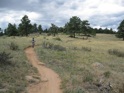
Como is on the edge of a huge valley, and occasionally the forest opened up to give us some great views.


The Chameleon blends in with the trees.


The boy and the dog cross a small creek. Once we were above the lower portions of the creek, which had been decimated by historic mining, the valley was quite beautiful. More of that classic Colorado mountain scenery.


Below, we're riding the road back down after deciding the ascent was just a little too much for us this time. Maybe we'll try again when we're all a little bigger. Running four miles on hard gravel road was too much for Mousie's feet. He had some holes worn through his pads when we finished.


We wanted to see the pass, so after getting back to Como on the bikes, we drove up to the pass and had lunch. It was chilly up there at 11,400 ft.


The girls were kind enough to let Quinn and me check out the downhill ride from the pass; they met us in the truck about half way down. Below, Quinn drops off a sharp ledge into a steep downhill.


The ride down from the pass started with a steep and rocky old two-track that was fast and rough, but wasn't really all that fun. Well, fun is relative; of course it was fun. But it got to be more fun after a couple of miles when the trail entered an old mining flume. The flume descends at a gradual but very steady rate, and the flume, which is really just a ditch, provides nicely bermed corners so it's sort of a like a bobsled track. It felt a little artificial, but it was enjoyable.


I guess this was my birthday ride. The following day I turned 44.

Saturday, August 18, 2012

Colorado Trail to Shinglemill Trail Loop

We finally made an all-scaq trip to the Buffalo Creek Recreation Area. I had ridden some of the Buffalo Creek trails before Cindy and the kids made the move, and have been looking forward to coming back again with the whole of scaq. This area is a little over 50 miles from our house, which makes a day trip out there a bit of fat carbon footprint adventure, but it's a pretty easy drive so it doesn't take too terribly long. I am, of course, always thinking about the carbon footprint of our mountain adventures. That's why we live close to my office and I bicycle to work most of the time. I save it during the week so we can burn on the weekend.

Getting back to the adventure: On the way out of town we stopped at a local bakery and picked up some yummy baked goods to supplement our breakfast. What a great idea that was!

After an hour or so on the road, we parked at the Little Scraggy Trailhead, paid our fee so we could make guilt-free use of the restroom, used it guilt-free, and then pedaled west on the Colorado Trail. Since this was going to be a longer trek, Quinn and I decided to share the effort and ride the Fandango, our big black tandem. It's almost as tall as Quinn!


Click here to see our Garmin log for this ride.

The ride west on the Colorado Trail was great. It was gently up and down, flowing side to side, along a smooth, gravelly trail. Perfect for the big black tandem! There were some more challenging sections, too, but only one that we couldn't quite clean on the tandem. And the scenery and smells were awesome! It smelled and looked just like Colorado: Grasses and gravel, granite and pines.


After about eight miles on the Colorado Trail, we turned back towards the northeast on Buffalo Creek Road, and rode dowhill on a gravelly two-track that's mostly closed to vehicles. The Garmin log shows a an increase in our average speed between miles 8 and 12. Much of this trail went through old burned areas and was wide open, sunny and warm. In other spots it was nestled in a tight valley beside Buffalo Creek.


Once we'd descended to the junction with Shinglemill Trail, we turned up and south to return to the Colorado Trail. Shortly after, we figured out that I had made a rather significant error in planning our route. I did not look closely enough at the Shinglemill Trail that connects Buffalo Creek Road with the Colorado Trail. I thought that it was mostly downhill, and promised our group that it would be fun and easy, but I was wrong! I mistakenly thought the trail climbed moderately up to a high point in the center between two valleys, and then descended toward the Colorado Trail. Nope. It was an honest mistake, but Shinglemill climbed and climbed all the way to the Colorado Trail. It was long and slow, and it was getting to be after lunch time. We had traveled more than 12 miles, and we, especially Abbey, were getting hungry. I'm not sure if it hurt or helped, but we had some remnants of those baked yummies waiting back in the truck, and that seemed to be all that Abbey could think about.

Climbing or not, the scenery on the Shinglemill Trail was just outstanding. The area was part of very large bun that occurred in 1996. The trail twisted and turned through a stark, treeless, exposed, and windy landscape. We could see for miles in all directions. We climbed just under 1000 feet in 3 1/2 miles, which isn't really terribly steep for a mountain trail, but it was a challenge because we we'd been riding for three hours and it was definitely lunchtime. Nonetheless, Cindy and Abbey pushed through, stayed strong and pretended to be happy, so I was very proud of them! They didn't exactly have a choice.

Quinn was my reserve engine on this ride. I'm sure I provide the bulk of the power most of the time when we're on the tandem; I am, after all, the bulk of the bulk. I currently weigh a little more than twice Quinn's weight. But there were a few instances toward the end the ride when Quinn and I were approaching a climb, when I could see it coming and was dreading it because I was getting tired, when suddenly Quinn kicked in a powered us up the hill. I literally didn't have to increase my power output at all! He just cranked it up and pushed us up the hill! It was awesome, and such a relief! I almost felt guilty!


The rocks on the Shinglemill Trail are rounded and fat. I don't know how they got that way, but I love them! The trail wound amongst them and sometimes over them. Look at Abbey climb them rocks!


Her Momma, too.


Once back on the Colorado Trail, the grade eased off and the flow returned. We buzzed back to the trailhead as quickly as we could. Our total ride distance coming in at about 17 miles. Abbey was first to arrive at the truck, and I think she was chomping down those baked yummies before Quinn and I had gotten out of our pedals!

Sunday, August 12, 2012

Hall Ranch Antelope, Bitterbrush, and Nelson Loop

On Saturday, August 11, we left Mousie home for the day and headed up towards Boulder and Loveland. The primary impetus for our trip was to meet up with Bob and BJ at Dale's tent at the Loveland Sculpture Invitational, but there was plenty of time in the morning to explore Hall Ranch, a park outside of Boulder that we had not previously visited. Well, actually, I had ridden at Hall Ranch with Heather and Chris many years ago, and I remembered that it was a beautiful park with some nice trails. My My Tracks app has not been cooperating lately, and Cindy didn't bring her Garmin, so we didn't track the ride with any of our GPS devices, but you can click here to see a map of Hall Ranch on the Boulder County website.

Since we were riding just single bikes (no tandems this time), we thought it would be best to come into the park from the east on the Antelope Trail. This saved us a little bit of distance and climbing, relative to the more popular entry on the Bitterbrush Trail on the south side of the Park. The Antelope Trail starts at an elevation of about 5650 feet and climbs about 400 feet in a little less than a mile. The trail switches its way up the hillside of rocks and red dirt amidst scraggly pines, grasses, yucca, and prickly pear. Quinn found some of the trail fairly steep and took his share of time-outs. We were not in a hurry. 


Hall Ranch's wide open hilltops and rolling terrain made for wonderful scenery. Very classic Colorado scenery. The trail surface was mostly smooth, and seemed to made from hard-packed sand. Rocks in places kept the riding interesting, but overall it was easy enough to allow for plenty of gawking at the gorgeous views.


At times the puffy, dark clouds in the sky added even more texture to the scenes, although at one point those dark clouds blew across with brisk winds, a rapid cool-down, and piercing rain drops. We quickly donned our rain jackets so that we stayed dry, but the rain passed quickly and the rain jackets went back in the packs immediately after.


Antelope Trail led to Upper Bitterbrush, and Upper Bitterbrush to the Nelson Loop. When we hit Nelson Loop it was time for a break, so I checked out the 2.2 mile loop by myself while the CA&Q rested up. I rode the loop counter-clockwise at the suggestion of our guide book, but afterward decided clockwise would be more enjoyable. When I finished my lone counter-clockwise loop, we set off as a group and rode it clockwise; definitely the way to go, in my opinion.

We reached the top of Nelson Loop, somewhere around 7600 ft, having climbed more than 1000 feet since leaving the trailhead, and our Quinn was running out of steam. Doesn't he look like he's nearing his end?


It's remarkable how quickly he recovered once we began the descent!


Once we were back to our truck at the trailhead we made PB&J sandwiches for lunch and washed off as much of the red dirt as possible before driving up to the sculpture show.

We also enjoyed the sculpture show. It was fascinating and inspirational to see all of the amazing creations. I think the kids really enjoyed the whole day. I certainly did. After the sculpture show, we had dinner with Bob, BJ, and Dale, and then headed back home.