On Saturday, August 11, we left Mousie home for the day and headed up towards Boulder and Loveland. The primary impetus for our trip was to meet up with Bob and BJ at Dale's tent at the Loveland Sculpture Invitational, but there was plenty of time in the morning to explore Hall Ranch, a park outside of Boulder that we had not previously visited. Well, actually, I had ridden at Hall Ranch with Heather and Chris many years ago, and I remembered that it was a beautiful park with some nice trails. My My Tracks app has not been cooperating lately, and Cindy didn't bring her Garmin, so we didn't track the ride with any of our GPS devices, but you can click here to see a map of Hall Ranch on the Boulder County website.
Since we were riding just single bikes (no tandems this time), we thought it would be best to come into the park from the east on the Antelope Trail. This saved us a little bit of distance and climbing, relative to the more popular entry on the Bitterbrush Trail on the south side of the Park. The Antelope Trail starts at an elevation of about 5650 feet and climbs about 400 feet in a little less than a mile. The trail switches its way up the hillside of rocks and red dirt amidst scraggly pines, grasses, yucca, and prickly pear. Quinn found some of the trail fairly steep and took his share of time-outs. We were not in a hurry.
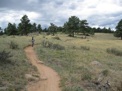
Hall Ranch's wide open hilltops and rolling terrain made for wonderful scenery. Very classic Colorado scenery. The trail surface was mostly smooth, and seemed to made from hard-packed sand. Rocks in places kept the riding interesting, but overall it was easy enough to allow for plenty of gawking at the gorgeous views.
At times the puffy, dark clouds in the sky added even more texture to the scenes, although at one point those dark clouds blew across with brisk winds, a rapid cool-down, and piercing rain drops. We quickly donned our rain jackets so that we stayed dry, but the rain passed quickly and the rain jackets went back in the packs immediately after.
Antelope Trail led to Upper Bitterbrush, and Upper Bitterbrush to the Nelson Loop. When we hit Nelson Loop it was time for a break, so I checked out the 2.2 mile loop by myself while the CA&Q rested up. I rode the loop counter-clockwise at the suggestion of our guide book, but afterward decided clockwise would be more enjoyable. When I finished my lone counter-clockwise loop, we set off as a group and rode it clockwise; definitely the way to go, in my opinion.
We reached the top of Nelson Loop, somewhere around 7600 ft, having climbed more than 1000 feet since leaving the trailhead, and our Quinn was running out of steam. Doesn't he look like he's nearing his end?
It's remarkable how quickly he recovered once we began the descent!
Once we were back to our truck at the trailhead we made PB&J sandwiches for lunch and washed off as much of the red dirt as possible before driving up to the sculpture show.
We also enjoyed the sculpture show. It was fascinating and inspirational to see all of the amazing creations. I think the kids really enjoyed the whole day. I certainly did. After the sculpture show, we had dinner with Bob, BJ, and Dale, and then headed back home.


Maybe I haven't been keeping up--who's Mousie?
ReplyDeleteMousie is Amos's nickname. The name "Amos" came from one of our favorite books, Amos and Boris, by William Steig. Perhaps you've read it. If not, perhaps you should. It's not a long book. It's the tale of a mouse and a whale who, through a series of unlikely events, become fast friends. It begins, "Amos, a mouse, lived by the ocean."
ReplyDeleteSo we call him Mousie. That could be part of his problem.