Monday, September 1, 2014

Monarch Crest Trail

Riding the Monarch Crest Trail had been on our priority list since we came to Colorado, maybe even before that, but until recently we thought it was probably too much for us. It's a big ride, and while it's more downhill than up, it's long and it's high. It was hard to figure out just how difficult we should expect it to be. Some have written that it is moderately technically difficult (suggesting some rocks and roots) but extremely strenuous; others that it is very technically difficult (as in lots of big rocks and steep drops) and extremely strenuous, so it was hard to tell. Either way, it was long. But we decided our time had come, so we put it on the calendar for Labor Day Weekend. 

Saturday morning we loaded up our stuff and drove the nearly three hours south and west from our house to Salida, where we spent the afternoon finding a hotel, swimming in the pool, and eating at the Moonlight Pizza and Brew Pub. The pizza alone was worth the drive. Since everything in Salida closes at 6 p.m., we watched Lord of the Rings movies in the hotel room that evening, while we packed and repacked our packs for our pending adventure.

We had a reservation for an 8 a.m. shuttle up to Monarch Pass on the High Valley Shuttle, so Sunday morning came early. Our breakfast of bananas, yogurt, granola, and coffee from Safeway was consumed in the cab of the truck. And then it was off to Poncha Springs to load our bikes onto the shuttle trailer.

We were not the only people riding up to the pass on the shuttle. There were three trailers full of bikes, plus a few extras, getting hauled to the pass that morning, but High Valley was well-organized, so despite the crowd, we got off with only a slight delay. The shuttle trailers have a series of vertical steel channels running down the center. Each channel accepts a crank arm, and except for a towel to pad and take up space in the channel, there is nothing else holding the bike to the trailer but gravity. It seems to work. We road in the van; our bikes on the trailer.


The drive to Monarch Pass was short. After a quick pee in the visitor center at the top, we were on our bikes and climbing. We had a really nice map of the ride, which was produced by Absolute Bikes in Salida. It had a topo map on one side and turn-by-turn directions on the other, with annotated photos of major intersections. It felt like navigational cheating, but was really helpful in keeping us from burning time trying to work through numerous potentially confusing intersections.

Click here to see the Garmin log and all the stats for the whole ride.

Right from the start the trail began to climb from the pass, officially at 11,312 feet, up to the Continental Divide at almost 12,000 feet. It was a challenge in the rarefied air, but we had agreed from the beginning that we would take our time, enjoy the scenery, and focus on conserving energy for the long ride ahead.


Obviously, with so many cyclists on the shuttle, we were not alone on the trail. At times, we were rather a part of a long line. However, at least half of the other riders were in much more of a hurry than we were, and after a few minutes we never saw them again. Other riders became almost companions as we periodically passed one another on the trail. Notably, many of them were visitors to the U.S. and spoke with thickly accented English. One of them offered to take our picture.


We were all excited about getting above the treeline, but Quinn was insistent that we get above all visible trees before we claimed success. So this isn't it yet. Treeline or not, the trail followed the Divide for miles, giving us incredible views in all directions.


A strong and often chilly wind was blowing across the Divide, but the sun was hot. The combination made for a pleasant temperature balance most of the time.


At this point it was pretty clear that we were above the trees.

                                 
Interestingly, while were riding with a generally slower group of riders, it seemed that many of them were less experienced mountain bikers. We rode many sections of trail that our trail companions chose to walk. Or perhaps they were just conserving energy.


Abbey takes a short break on the downwind side of a small grove of trees. 


And then a big, steep drop down to the saddle with Greens Creek to the north and Agate Creek to the south. Quinn thrives on those gnarly downhills, although he's continuing to have some wrist pain as a result.


Somewhere around mile 10, the glorious alpine singletrack came to an end, and we descended steeply and very quickly down a rocky four wheel drive road. A long sequence of jumps -- or water bars -- made for lots of air time. At the bottom was Marshall Pass, with a parking lot and restrooms. We stopped for the restrooms and then found an out-of-the way spot for a lunch of pretzels and chocolate chip bagels with peanut butter, chocolate, or hazelnut spread. After lunch, we were back on rolling Continental Divide Trail singletrack mixed with some doubletrack for another four miles. Quinn struggled a bit with some tummy issues at this point, but eventually got through it.

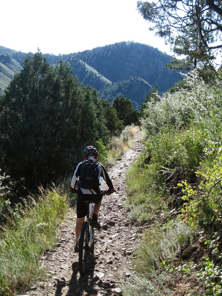
We followed the Continental Divide Trail almost straight south for another four miles before finally dropping down the Silver Creek Trail to the east along Silver Creek. At that point, the nature of the trail changed. The sides of Silver Creek canyon are steep and loose. The trail is a narrow line traversing steep scree slopes in several places, while losing 2,000 feet of elevation in five miles.


In picture below, Cindy and Abbey are starting down the trickiest section of trail we'd encountered yet. Just short of 19 miles on the odometer, the trail drops down a very steep and very loose scree slope. The trail surface becomes a coarse gravel or small cobble; it rolled under our tires, turning steering and braking into fuzzy approximations. Quinn and I skied down it, enjoying the precariousness of it. I think Cindy and Abbey found it less amusing.


And then we reached the point where Silver Creek Trail and Silver Creek become one.


The ride in the stream was short, and Cindy did not live up to her (probably false) reputation for falling into creeks. She and Abbey road side-by-side down the creek trail without incident.


Soon we reached the end of Silver Creek Trail and had to make a decision. We could either take the Rainbow Trail for nine more miles of rolling (as in up and down) singletrack, or we could follow a gravel road beside Silver Creek for an easy downhill. The two routes would meet again, but not before their junction at the paved Highway 285. So we snacked and watch the majority of other cyclists who came down the trail opt for the gravel road along Silver Creek. A few brave souls took the Rainbow Trail. Feeling brave, we followed them. At that point, Abbey started to get just a little grumpy.

The Rainbow Trail was really nice in most places. It flowed smoothly along the slope above Silver Creek, often just a narrow ribbon draped across a steep slope. But the flow was punctuated by very steep, rocky ascents, often up moto-shredded, rocky hillsides. Many of those climbs were long off-the-bike pushes for all of us. We were getting tired. It became a test of physical and mental endurance for the kids. And for Cindy and me, too, but it's different for adults -- we're sort of used to the long slow grind.


Once the Rainbow Trail began to descend back to Silver Creek, it did so in a big hurry. This was one of the steepest sustained descents we've ever ridden. Down, down, sometimes with lots of rocks. Quinn took a light spill once.


And then we were on Highway 285 for five fast miles on a wide, paved shoulder to get back to our truck in Poncha Springs. It was tough, as an epic adventure should be, but we did it. And we'll do it again.

Tuesday, August 26, 2014

Centennial Cone Loop Once

We love Centennial Cone Park. It's just a little west of Golden on Highway 6, but the park is wild, wide-open Colorado and the trail feels miles from anywhere. For most of the 12 miles of trail, there is hardly a sign of civilization, excepting the trail itself.

Click here to see the map and the other Garmin info from our ride.

The trail is really a couple of trails that link together to make a big loop. The Travois Trail, as it's name suggests, is a lengthy traverse along a sometimes very steep slope. The Elk Range Trail, which we rode at the end of the loop, cuts across wide expanses of meadow frequented by calving elk at the right time of year. We didn't see any.

I'm too tired to write much tonight, so I'll just post some photos from our Sunday morning ride. And then I'll go to bed. There more details from a previous trip posted here.


Thursday, August 14, 2014

Eat More Beans

We've lost touch with our children. This is all they do. Ever. We actually took away Clash of Clans, since it required constant maintenance from Quinn, but installed Minecraft on our home computer in trade. 


Quinn starts middle school tomorrow and Abbey has been in marching band camp for the last couple of weeks. So summer is over and it's only the middle of August. But that's no surprise, because there's really not much that goes on here that actually makes any sense.


For example, my parents came out and brought their oldest and youngest grandchildren. We rode our bikes to a flood control structure to play. We also went to the zoo, where we truly belong, and we rode a real Galloping Goose, although not at the zoo.


And we had a tornado a week before they came. Funnily enough, we'd had a woman from southern California out to my office for a job interview, and on our way out to lunch, she commented on the tornado shelters in the Denver airport. The idea of being in tornado country seemed to worry her. We assured her that it was very rare to for a twister to hit Denver. Later that afternoon, I took this picture out my office window while she was sequestered in one of those tornado shelters at the airport.


And while I'm on the subject of bad weather, I'll share a few pictures from a recent bike ride on the Bear Creek Trail, which starts in Lair o' the Bear Park just west of Denver. We like to do our trips to the mountains early in the day to avoid the classic afternoon thunderstorms -- of which we've had plenty this year. But last weekend Abbey was working an ice cream social at the zoo in the morning, so we picked her up at noon to go dodge lightning bolts in the mountains. It was really fun. And scary. Despite the weather, the park was packed when we arrived, so we had to park our truck quite a ways down the highway and ride up to the park. It was raining when we started; Quinn and I hid under a tree to get out the rain waiting for Cindy and Abbey to catch up and captured the photo below. We had split up when riding through the crowded path along the creek.


You don't have to go far to leave the crowds behind. There's something of an exponential decrease in the number of visitors with increasing distance up the trail. Usually we try to ride up this staircase in the photo below; I've come close, but never made that final turn. With damp rocks and wet, sandy tires, this was not a good day for riding up steep rocks.


Abbey just can't quit marching.


Who need's traction?


But when the lighting got really close, we turned around and headed down. So it was a short ride, but we were trying to squeeze it into a short window of time between the zoo and Quinn's evening Colorado Honor Band Concert. Quinn has a healthy fear of lightning, so it was a little hard to keep up with him once we made the decision to get off the mountain.


Now it's time for bed. School starts tomorrow, and Cindy has to be at the bus terminal at 5:15 a.m. 

Sunday, July 20, 2014

Buffalo Creek Again

We're purposefully pushing ourselves to extend the length and intensity of our rides so that we get strong enough to ride more of Colorado's classic mountain bike rides. As the dad, and, as the Rocky Mountain National Park ranger named me, "the group leader," I have to be careful to make sure that I'm not pushing too hard. No one would thank me for that, but so far, I think we're all on board with the concept. And since I'm no longer running, I need to do something to stay strong and stave off love handles and beer belly.

So for today's adventure, we stitched together a Buffalo Creek area ride that would give us more than 20 miles of riding and about 2,000 feet of climbing. It worked out well and we all had a great time. Click here to see our route. We started up the Buffalo Creek Road, a mostly closed road that follows Buffalo Creek upstream for about four miles, while gaining an easy 500 feet of elevation. At the top, where the Gashouse Gulch and Mount Baldy trails depart to the north, we stopped for butterfly break.


We followed Gashouse Gulch Trail uphill through a large burned area until we reached Redskin Creek Trail, and re-entered the forest. Even though we'd started at 9 a.m., the sun was hot and we were relieved to find shade in the forest. This area burned about 20 years ago, yet there are almost no new trees sprouting up. It's a stark landscape, dominated by gravel, grasses, and small shrubs. The round pink lumps of granite add texture. It's wonderful.


Redskin Creek Trail connects with Gashouse Gulch Trail at about mile six. We'd just reentered the forest, having climbed about 1,000 feet in the sun. Redskin Creek Trail wound quickly down to the Creek, descending about 150 feet. It was a really nice smooth, roller coaster sort of flow trail. A pleasant surprise.

But before we got going on Redskin, we spent a little time slurping water and being silly.


Redskin Creek Trail took us to the Colorado Trail, which we followed back to the east for about eight miles. It climbed, mostly gently, for about 1,000 feet, and then began to descend. The Colorado Trail is really nice. Most of it is within the forest, running along the north-facing slope above Redskin Creek. The trail is mostly smooth and gravelly with lots of roots and a few rocks to keep it interesting.


By the time we finished our eight miles on the Colorado Trail, Quinn was beginning to feel a little dizzy or light-headed. We weren't sure exactly what the problem was; he'd had plenty of water, we'd had a good snack along the trail, and it wasn't overly hot. Still, I was worried about possible heat exhaustion, so we stopped at a picnic table at the Little Scraggy Trailhead for fairly long break so he could cool down and, we hoped, start feeling better. He had a snack and rested, and improved somewhat, but still didn't seem to be quite 100% when we got back on the trail. Since the rest of the ride was downhill, I figured he be alright. And he did indeed improve, but was left with a bit of a headache.


We went north from the Little Scraggy Trailhead on the Buffalo Burn Trail. The view out across the valley was incredible, with puffy clouds moving in as predicted.


When the lightning began, we felt too exposed on Buffalo Burn and the Nice Kitty Trail, but that just helped us pick up the pace towards the valley.


Abbey is lost in the forest of skeletons on Nice Kitty Trail.


Nice Kitty is a new trail, but is fairly similar to other Buffalo Creek trails. Lots of smooth flowing trail punctuated by interesting rock obstacles. Quinn took this one easily, of course.


We did not get struck by lightning. The bridge at the north end of Nice Kitty Trail takes us across Buffalo Creek and connects to the Buffalo Creek Road, just about a half mile up from the parking area. Of course, we hit the parking area just as the rain hit, so we spent some time sweating in the truck while we waited for the rain to pass.


It was another great trip, ending up at about 22 miles, just under five hours, with about 2,000 feet of total climbing. Very fun; very pretty. As for Quinn and the dizziness, our best guess is that he was just getting tired and hungry. So next time, we'll try to feed him more often, but otherwise we'll just keep at it and see how it goes.

Sunday, July 13, 2014

Dakota Ridge

Dakota Ridge Trail is one I'd ridden alone a couple of years ago (click here to review), and found to be quite challenging and almost fun. It's one of the north-south hogback ridges that comprise the first wall of mountain on the west side of Denver. Riding it is just as challenging as you might imagine it would be to ride along the fracture-surface of a mile-long, broken slab of limestone jutting up 300 feet out of the ground at 75 degree angle.  In terms of distance, I'm sure I was able to ride more of it than I walked -- or dragged my bike through -- but in terms of time, I'm not so sure: it's possible that I spent more time bike-dragging than bike-riding.

So I thought Quinn would enjoy it. Cindy and Abbey were busy, so on 13 July 2014, Quinn and I rode the ridge from north to south and then returned by way of the much smoother Red Rocks Trail. I screwed up the Garmin track, so I have no link to the route, but it was similar to that of my previous ride at the hyperlink above.

This is the view from the north end of the north end of the trail, looking south and a little west, towards the mountains of Southern Colorado. Here the trail is smooth.


But it doesn't stay smooth.


I'm not sure what to call them, but these log-ramps are common on the heavily-used Front Range trails. They are good fun, up or down.


It is possible to ride this stuff, if you're young and strong and Quinn and crazy. But it's best to wear a lot of padding.


This was a nice smooth climb, reminiscent of some of the trails in Moab.


The views were incredible in both directions. We had a lot of fun, and finished unscathed, but for a few small bruises and scrapes, including those that spanning the space between my chin and my nose; fairly minor once I dug the sand out from under my upper lip.